Know where the storm is headed.
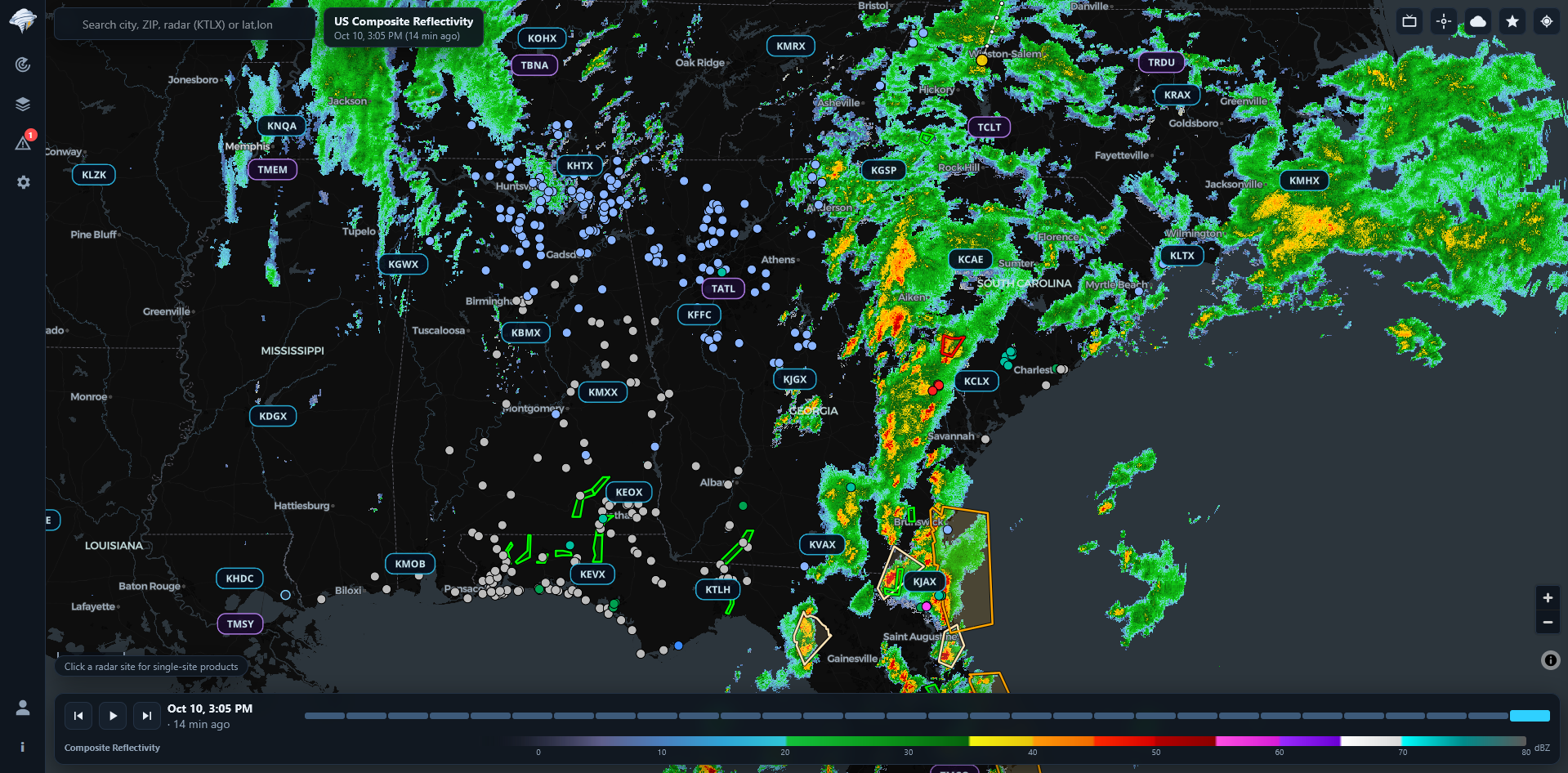
Live radar from every NEXRAD site in the US, every National Weather Service warning, and an estimate of when storms will reach the places you care about. Use it in your browser today. Apps for iPhone, Android and Windows are on the way.
Free, Plus and Pro plans. Compare plans
- –Tornado warnings
- –Severe T-storm warnings
- –Flash flood warnings
Live from the National Weather Service. Broadcast mode shows the same index for the area on your screen.
- 159NEXRAD sites
- 45Airport TDWRs
- 19Radar products
- 1991Archive back to
What WeatherVector does
See when a storm will reach you
For your current location and each saved place, WeatherVector follows the track of every strong storm and estimates when it will get there.
- Arrival lines on the map. A dashed line runs from each storm to the place it's heading, labeled with the minutes until it arrives.
- What it's bringing. Rotation, tornado signatures, hail size and heavy rain, along with the storm's direction and speed.
- Push alerts. WeatherVector can alert you when a strong storm is forecast to reach one of your places within 30 minutes, even with the app closed.
- Warning banner. If a warning covers one of your places, a banner shows it at the top of the screen.
Raw radar data, drawn on your device
WeatherVector downloads the same Level II and Level III files the National Weather Service publishes and renders them with your graphics card. You see full-resolution data instead of blurry image tiles.
- Every radar in the US. All 159 NEXRAD sites and 45 airport Terminal Doppler radars, plus Alaska, Hawaii, Guam, Puerto Rico, and US military radars in South Korea and Japan.
- Every tilt. Level II gives you every elevation the radar scans, not only the lowest. Level III products usually show up 1-3 minutes after the scan.
- Inspect tool. Tap any spot to read the exact value, distance from the radar and beam height.
- Your color tables. Import GR2Analyst or RadarScope .pal files for any product.
Warnings, outlooks and hurricanes
Every active National Weather Service warning and advisory in the official colors, updated every minute, with push alerts for the places you save.
- Full warning text. Tap a warning to read hail size, wind speed and whether a tornado was observed.
- SPC watches and outlooks. Watches, mesoscale discussions, and Day 1-5 outlooks with tornado, wind and hail probabilities.
- Hurricanes. National Hurricane Center cones, tracks, wind fields and 5-day wind probabilities.
- Your alert types. Choose which warnings notify you for each place, with a siren or chime sound.
Rotation and hail tracking
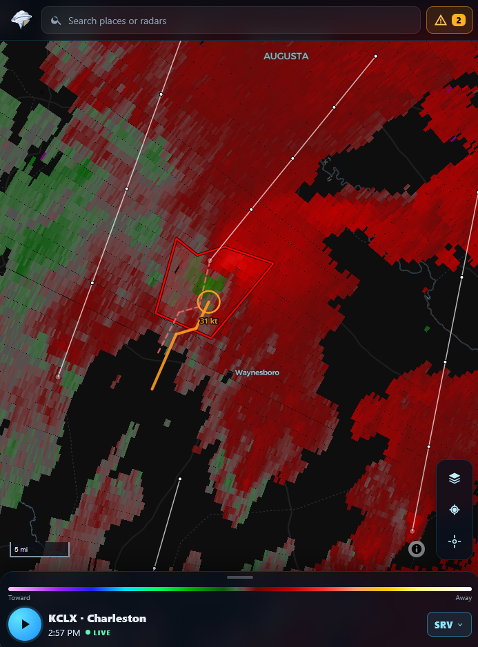
On every new scan, WeatherVector looks for rotation and circles it on the map, colored by strength.
- Debris signatures. When strong rotation lines up with low correlation coefficient, the ring turns magenta and is labeled "DEBRIS".
- Tracks. Rotation is linked scan to scan so you can see its path. Hail swaths from the last two hours are colored by size.
- The numbers. Tap a ring for rotational velocity, inbound and outbound speeds, couplet width and beam height.
Tools for chasers and spotters
Pro adds faster data and the tools to look inside a storm, replay past events and share what you see.
FastScan
Real-time Level II. Each tilt shows up seconds after the radar scans it.
Cross sections
Draw a line through a storm to see a vertical slice from every tilt.
Quad view
Four synced maps of one radar, each showing a different product.
Archive replay
Load any radar at any past date and time, back to 1991.
Loop export
Save a loop as a GIF, MP4 or WebM with the time and legend on it.
Share links
Send a link that opens the same radar, product, tilt and time.
Use it on your live stream
Stream severe weather from home with OBS, or from your phone when you're out on the road. Broadcast mode adds warning graphics and your own branding on top of the radar.
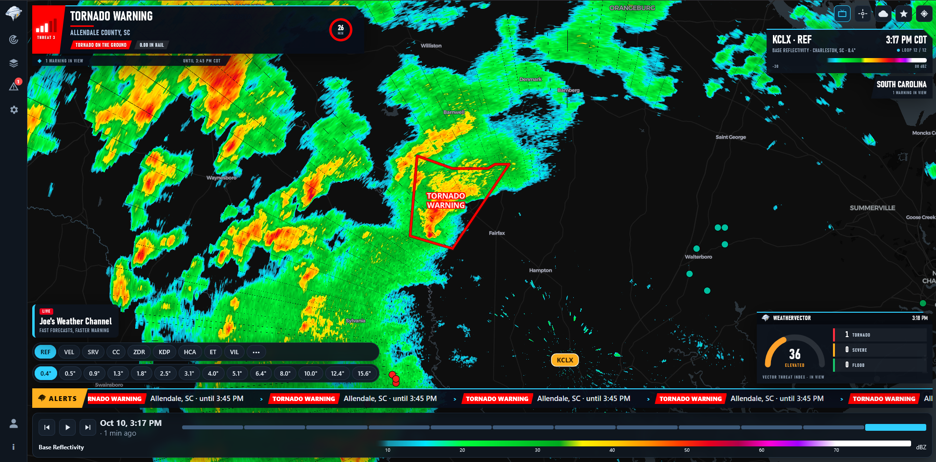 Warning bulletinThreat level, hazards and time left
Radar cardSite, product, scan time and loop
Your lower-thirdYour channel name and logo
Vector Threat Index0-100 with warning counts
Warning bulletinThreat level, hazards and time left
Radar cardSite, product, scan time and loop
Your lower-thirdYour channel name and logo
Vector Threat Index0-100 with warning counts
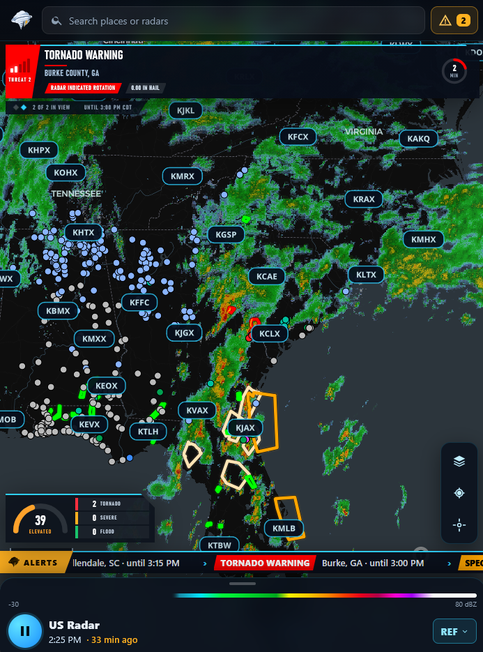
Warning bulletin
Shows the warning, county, a 1-5 threat level, hazards like "1.75 in hail" or "tornado on the ground", and a countdown to when it expires. It cycles through every warning on screen.
Vector Threat Index
A 0-100 gauge based on the type and severity of the warnings in view, with tornado, severe and flood counts.
OBS overlay
Copy a link into OBS, Streamlabs or vMix as a browser source. Use the full radar scene, or just the graphics on a transparent background.
Scenes
Save up to 9 map views and switch between them while you're live with Shift + 1-9.
Themes and branding
Pick from Midnight, Storm Red, Arctic or Mono, and add your own name, tagline and logo.
On your phone
A compact layout for streaming from the field, with the same bulletin, gauge and crawl.
Choose a plan
| Plans | Free $0 Radar, warnings and alerts for your places. Open web app | Plus $3.99/ month Adds broadcast mode and more ways to get alerts. Get Plus | Pro $9.99/ month Adds analysis tools for chasers and spotters. Get Pro |
|---|---|---|---|
| Radar and alerts | |||
| All 19 radar products, Level II and III | ✓ | ✓ | ✓ |
| Warnings, watches, outlooks, storm reports | ✓ | ✓ | ✓ |
| Hurricane cones, tracks and wind probabilities | ✓ | ✓ | ✓ |
| Storm arrival times, lines and alerts | ✓ | ✓ | ✓ |
| Push alerts for saved places and siren sound | ✓ | ✓ | ✓ |
| Satellite, observations, forecasts | ✓ | ✓ | ✓ |
| Radar loops | 10 frames | 30 frames | 30 frames |
| Broadcast and alert options | |||
| Broadcast mode, themes and lower-third | – | ✓ | ✓ |
| OBS overlay and scenes | – | ✓ | ✓ |
| US-wide alerts by type and state | – | ✓ | ✓ |
| Tornado and flash flood emergencies anywhere | – | ✓ | ✓ |
| Alert zones of 5-50 miles | – | ✓ | ✓ |
| Settings sync | – | ✓ | ✓ |
| Analysis | |||
| Rotation and hail tracking | – | – | ✓ |
| FastScan real-time radar | – | – | ✓ |
| Cross sections and quad view | – | – | ✓ |
| Archive replay back to 1991 | – | – | ✓ |
| GIF and video export | – | – | ✓ |
| Share links | – | – | ✓ |
Get WeatherVector
The web app works now in any browser. The iPhone, Android and Windows apps are in development. Your account, saved places and alerts carry over to all of them.
Common questions
What do Plus and Pro add?
Plus adds broadcast mode, the OBS overlay, US-wide alerts, custom alert zones, 30-frame loops and settings sync. Pro adds rotation and hail tracking, FastScan, cross sections, quad view, archive replay, loop export and share links.
Where does the data come from?
NOAA, the National Weather Service, the Storm Prediction Center, the National Hurricane Center, NASA and the Iowa Environmental Mesonet. Radar files are decoded on your device. See the full list on our support page.
Can I use it on my stream?
Yes, with Plus. Copy the overlay link into OBS, Streamlabs or vMix as a browser source. You can show the full radar scene or only the graphics over your own capture.
When are the phone and Windows apps coming?
They're in development. Until then, you can use the web app in any browser and add it to your home screen or desktop.
Does it work outside the US?
Radar, warnings and forecasts cover the US and its territories, plus US military radars in South Korea and Japan. There's also a global radar mosaic.
Can I cancel anytime?
Yes. You can upgrade, cancel or get invoices anytime through Stripe. Your card details go to Stripe, not to us.
Know where the storm is headed.
Open WeatherVector in your browser. There's nothing to install.